| Loc: E Santa Cruz Island | Lat: N34-02.8 | Long: W119-32.8 | Last visit: Nov 2023 | ||
| Tide/Sun/Moon/WX | Dist: 7 | Prisoner’s Harbor, Santa Cruz | WX | ||
| Chart | 18729 | Anacapa Passage | Google Earth | ||
| Skipper: Capt. Dan | Boat: S/V Sancerre | Capt. Dan | Channel Islands | ||
| Landing Permit | No | Local Notice to Mariners | NPS Alerts |
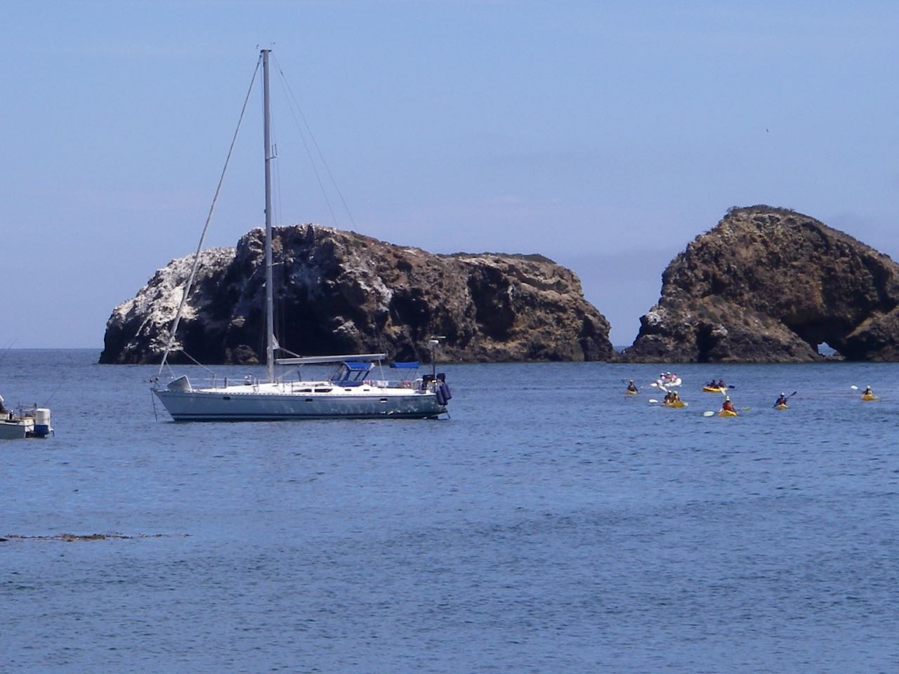
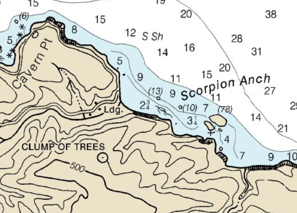
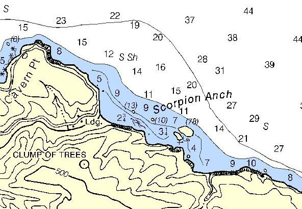
Scorpion anchorage
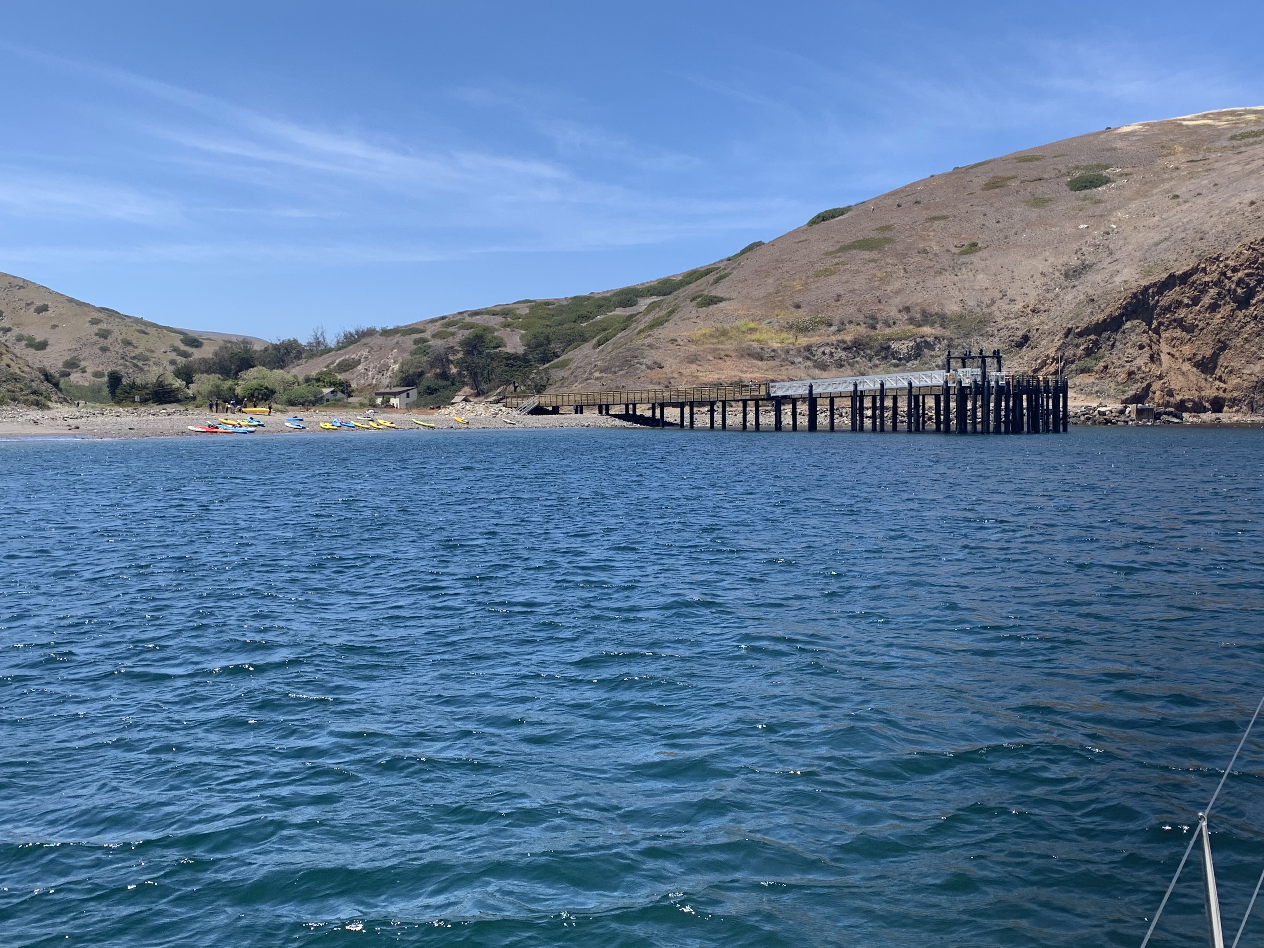
Scorpion, the gateway to the island’s activities, is open once again and the pier is available to Island Packers, NPS and other government boats.

All others must anchor out and it is best to stay well clear of the mooring field, which like the pier, is for official use only.
Little Scorpion Anchorage
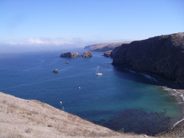
Little Scorpion is the primary overnight anchorage. It usually affords protection from the prevailing westerlies, but the swell can enter the anchorage, making for rough and sleepless nights.
If I plan to spend the night, I also plan a backup. Swell, wind and, on one occasion, the smell from Bird S**t Rock (78) have encouraged me to find another spot for the night. And speaking of the smell, it just isn’t a problem right now. The Park Service planted the rock a few years back and, though they didn’t expect their efforts to cover the islet, they were probably ecstatic at the success they’d achieved.
But alas, Bird Shit has won in 2021. And the rock is again a giant white beacon beckoning sailors to spend some time.
Finding the anchorages

Find the great white beacon of Bird Shit Rock. Scorpion and the interpretive center are west, Little Scorpion for overnighting is just east.
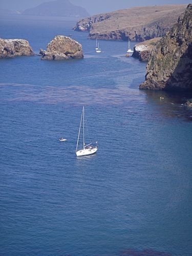
If you’re north of the anchorage, locate the steep cliffs of Cavern Point. That’s less than a mile NW of Scorpion and visible from the mainland on a clear day. Once you’re oriented, shape a course slightly to the east of the point. You’ll likely spot Scorpion Canyon next. It runs right into the day anchorage. There is a huge, new pier in the SW corner and two mooring balls.
Note: Giant Kelp, which has been in decline for more than a decade is making a comeback. That’s good for the ecosystem, but makes navigating a little tougher.
Little Scorpion is a fraction of a mile east.
Anchoring at Little Scorpion
The anchorage is quite deep and you’ll find that you have to maneuver in fairly close to anchor in less than 35 ft. The bottom is mostly sand, though we have encountered some eel grass.
We generally anchor bow and stern to prevent swinging. Other boats line up beam-to-beam in a East-West behind Scorpion Rock. I prefer the spots in the SW corner of the anchorage but will accept the second tier spots that are farther out. There is also room to moor east of the primary spots close to shore.
It is very deep in the center of the bight, which makes anchoring bow and stern problematical.
On the other hand, if it’s late in the day and we’re the only ones looking for a spot, we’ll sometimes use a single hook in the center of the anchorage.
Hazards
Nothing that you can’t see. The bottom is sand and holding is excellent and kelp is not an issue these days. Eel grass might be. Occasionally, abrupt wind shifts (though not necessarily Santa Anas) will suddenly make your secondary anchor the primary. Our advice is to ensure you’ve got 7:1 scope at both ends if you’re using rope rode and make sure both are set hard.
Even though we had plenty of scope in December 2022, a wind shift to the northeast made it impossible to retrieve our secondary anchor by slacking the primary. The rode simply bowed and we couldn’t get over the stern hook. At this point we were in danger of being blown into the rocks to the east. We reluctantly tied a fender to our aft rode and jettisoned the ground tackle. We attempted to retrieve it but wind and waves made that too hazardous. Fortunately for us, our friend Rex was able to blast out there in his Whaler a few days later and pick it up.
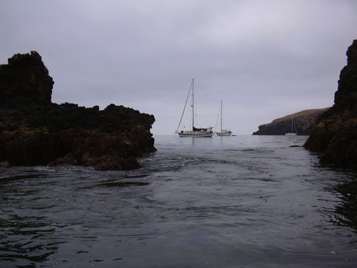
Scorpion Anchorage
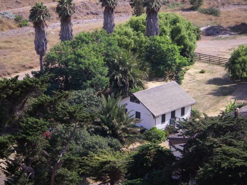
The shore near Gherini (Scorpion) Ranch has two distinct anchorages. Island Packers uses Scorpion (the western one at the mouth of the valley where the ranch house and interpretive center are located) to offload hundreds of hikers, backpackers and kayakers. It can get very crowded here, particularly when kids are on summer vacation.
We stay well clear of their dock, which is tucked in the west corner of the anchorage.
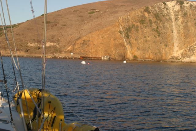
When we intend to spend only a few hours, we prefer to drop a single hook just shoreward of the charted 13 ft. rock (just left of the “S” in Scorpion on the chart) in 20-25 feet of water but will accept a spot almost anywhere along the beach and will anchor to within 100 yards west of Bird S***t
rock(78′ rock) if we have to. But remember, for a yacht on a single hook, this is, at best a fair weather anchorage. The swell frequently creeps around the corner in the Island Packers
anchorage and it can be difficult to get close enough to the shore to get out of the westerly wind.
The bottom in this area is sandy in many parts, but there are areas of mud and weed where holding is less secure. On the other hand, this is where you can bring your dinghy or kayak ashore with ease.
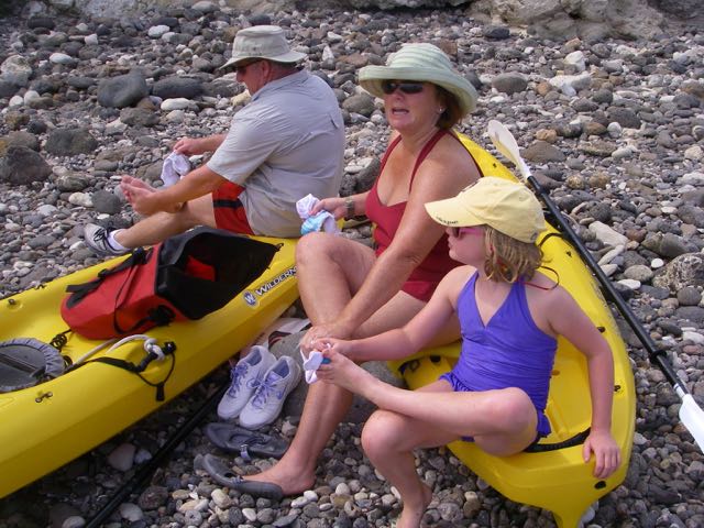
There is rarely any breaking surf, which makes this one of the few easy places to come ashore on Santa Cruz. The beach comprises fairly large rocks, so water shoes or sandals are essential.
We rarely anchor here overnight. The video explains our method and describes our trepidation.
BTW – we don’t leave the boat unattended for more than a half hour or so. The wind over the course of the day will frequently vary between nada and 20 knots. As we’re only two or three boat lengths from a lee shore, we are skittish about taking the whole family ashore.
Note: Kelp, which virtually disappeared from all of the islands, is rebounding with vigor at Scorpion and covers the surface south and east of (10) rock. It’s now a significant obstruction.
Photos


Scorpion Attractions
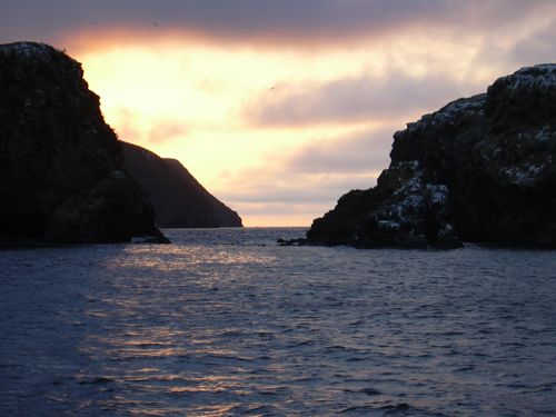
Scorpion has the best kayaking spots on the island. Painted Cave, further west, is far more vast, but the caves near Scorpion are easily accessible and require no spelunking gear. They’re not very scary, either. Nevertheless, take time to observe the swell and surge before you make a decision about entering.
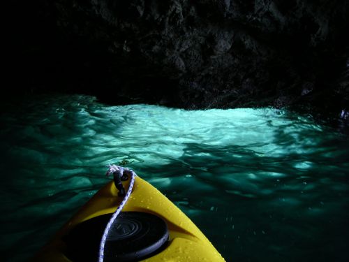
Don’t miss the Blue Grotto sometimes called Emerald Cave, which is accessed on the east side of Bird Sh**t rock. It’s got a cathedral-high ceiling, a grand light show and a passage through the rock itself.
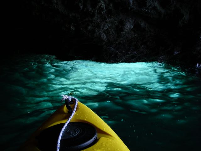
If you drop your boat in the water when the sun just peaks over Anacapa, you’ll likely find glass-smooth waters and excellent visibility. It can be more revealing than any aquarium as you see in this picture of the bottom, which was not shot from underwater, but sitting in my plastic boat.
And don’t miss the loop trail to Potato Harbor. It’s some of the most spectacular scenery in California.
Kayakers Caution
While this is a great spot for exploring in your plastic boat, many of the caves have dangerously low ceilings. A little bit of tidal rush, a biggish wave, maybe just the wake off a tourist boat can ram you into the ceiling. Even with a helmet, you could still be crushed if you’ve picked a cave with poor clearance. Additionally, if you leave the shelter of the anchorage, be aware of the afternoon westerlies, particularly in summer, which can make paddling back to your boat extremely difficult. We generally paddle west in the morning and, if we’re on a long trip, in good position to ride the westerly home.
Landing Permits NOT Required
Permits not required; it’s your national park. For information about camping ashore, guided tours and facilities, go to National Park Service. For additional information about the joint conservation efforts of Nature Conservancy
Updates
If you have new or amplifying information concerning this anchorage or the surrounding area, please contact Capt. Dan .