| Loc:South coast Santa Rosa | Lat: N33-54.2 | Long: W120-06.07 | Last visit: Sept 2017 |
| Tide/Sun/Moon/WX | Dist: 7 | Bechers Bay, Santa Rosa | WX |
| Chart | 18728 | Santa Cruz Channel | NPS Alerts |
| Skipper: Dennis the Bosun | Boat: S/V Sancerre | Boatswain | Port: Chan Islands |
| Landing Permit | Not Required | Local Notice to Mariners |
Even though Santa Rosa Island is now fully under the control of the National Park Service, there are still some places you must avoid. You no longer have to worry about getting shot, but you should still check NPS alerts as certain beaches are closed from time-to-time to protect the snowy plover nesting sites as well as pinniped rookeries (seals, sea lions, elephant seal nurseries).
Anchorages
There are relatively few anchorages on Santa Rosa Island, and most of those visiting this island are drawn to Becher’s Bay NW anchorage, often not venturing beyond this large, well sheltered and popular anchorage. However, heading around East Point up the south west coast of the island to Johnson’s Lee is well worth the trip in the right conditions. However, this anchorage is untenable when the winds are out of the southeast or there is a southern swell. Also, as mentioned above, strong winds out of the west can also make for a pretty unsettled night.
Approach
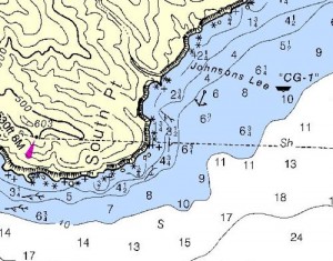
The approach to Johnson’s Lee is fairly straight forward as it lies immediately NE of South Point (the southern most point of Santa Rosa Island). However, finding the “sweet spot” can be a bit of a challenge.
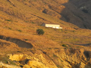
Brian Fagan states in The Cruising Guide to Central and Southern California (revised 2002) “The buildings on the slopes are visible from a long distance. Steer for the pier immediately below them. Unfortunately (or fortunately for the sake of returning the island to its natural state), these buildings and the pier no longer exist, and all traces of them have been eliminated. There is, however, some sort of storage shed that is visible for miles. The light on South Point looks like it should be a good landmark, but don’t expect to see this light when approaching from the south east. While it should be visible when approaching from San Miguel Island, spotting may also be a little difficult (except at night, which we’re not likely to attempt).
If you’re intrigued by the 669th Aircraft Control and Warning Squadron and the phantom Air Force Base that used to be at Johnsons Lee, check out this article.
How we did it, specifically
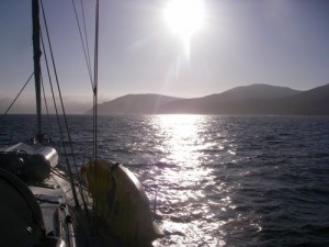
We’ve made the run from Yellowbanks on the far east end of Santa Cruz a couple of times. Last time out, we headed fairly far off coast on a southwesterly heading in search of wind and perhaps a few dolphins and maybe a whale or two.
Fortunately, we encountered all of the above (including the largest and most active pod of Fin Whales any of us had previously seen). On our spring 2014 trip, we encountered transiting gray whales and a lonesome bull elephant seal in the anchorage.
We had sailed far enough out so that when we tacked we were on a northwest heading that practically took us straight into Johnson’s Lee.
Finding the right place to drop the hook at Johnsons Lee required a little more poking around as the landmarks listed in Fagan are all gone. In addition, there is a fair amount of kelp to be avoided. While the anchorage is quite large, care must be taken to avoid anchoring at the base of the canyon where strong winds can at times come roaring through. At the same time, care should be taken so as to not to get too close to the northern shore where (according to Fagan) it is rocky and the holding is poor.
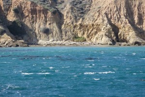
We wove our way through a small kelp bed, and dropped the hook in approximately 25 feet of water, a half mile or so off shore, paying out about 200 feet of chain. The wind was blowing almost 30, but we were well sheltered from the swell that had been punishing us for two days. Note: The mooring buoy shown on the charts has been removed. (But may come back.)
Going Ashore
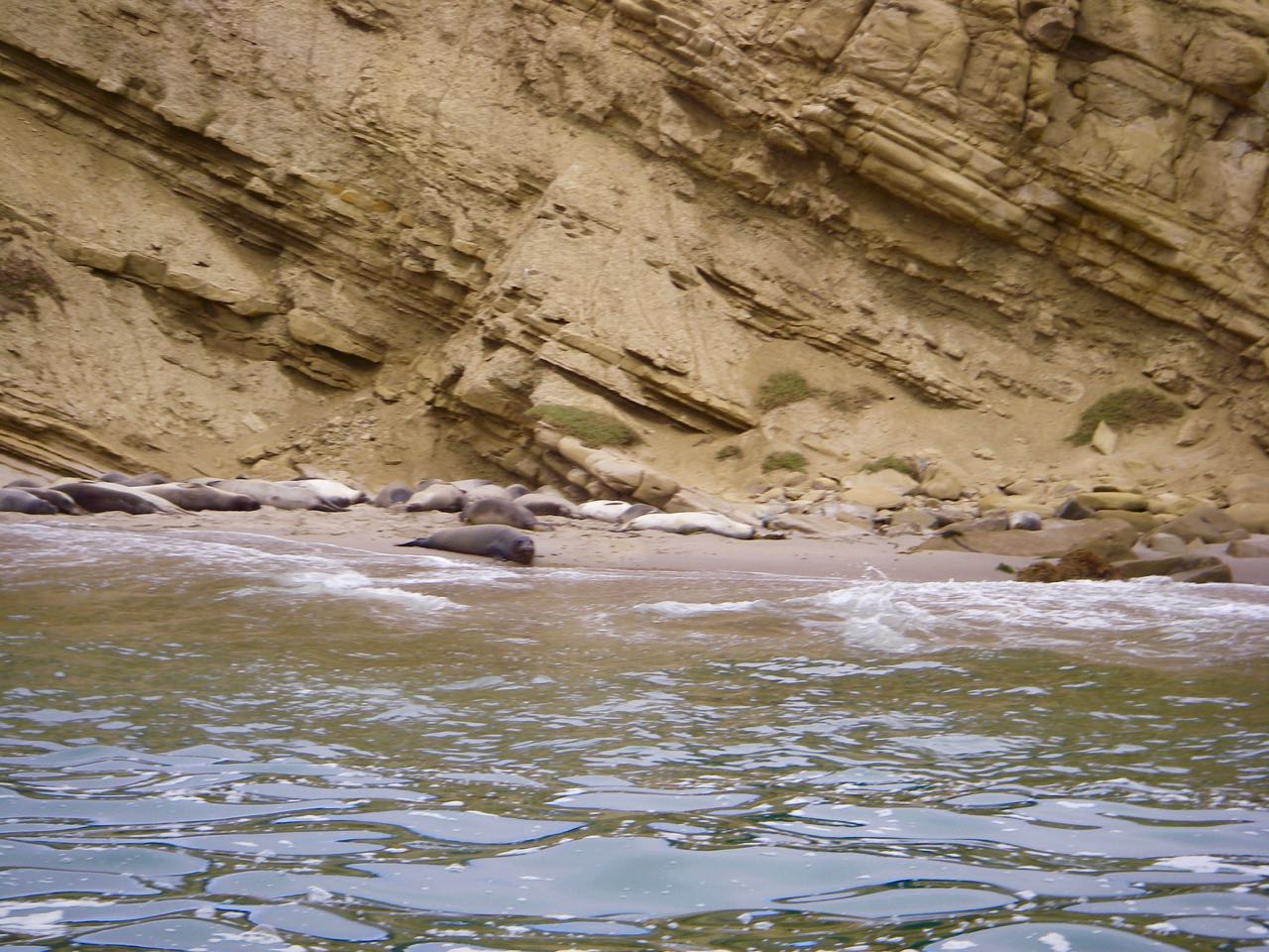
Go to Santa Rosa Island for general information including history, topography, flora and fauna of Santa Rosa and an excellent slide show on the Channel Islands National Park website. Getting ashore at Johnsons Lee could be difficult as the most convenient beach was full of elephant seals.
Hazards
None that aren’t charted or visible. Well, other than elephant seals.
Updates
If you have new or amplifying information concerning this anchorage or the surrounding area, please contact Captain Dan.
.
Photos
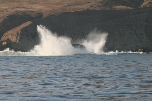


 blocked by South Point. Any south swell comes right in.")

