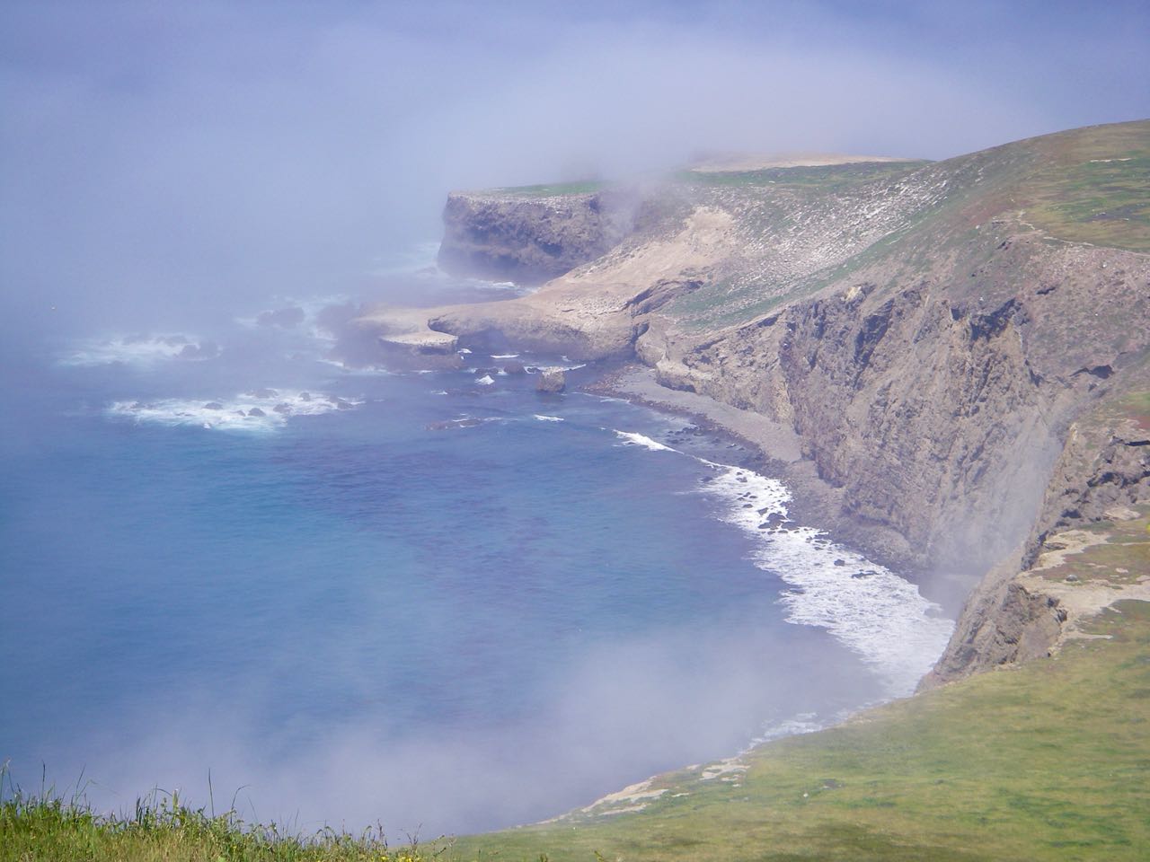
| Santa Barbara Island | Lat:N33-28.9 | Long: W119-01.8 | Last visit: Sept 2022 |
| Tide/Sun/Moon/WX | Dist: 0 | Santa Barbara Island | WX |
| Skipper: Capt. Dan | Boat: S/V Sancerre | Capt. Dan | Channel Islands |
| Landing Permit | No | Local Notice to Mariners | NPS Alerts |
Correction:the dolphins in the video are common dolphins, not white-sided as stated.
The Island is open …. sort of
As a practical matter, you can’t get ashore because the dock has been destroyed and NPS has no urgent plans to repair it. Though the sea lions have cleared out since last report, it’s still not easy and, in most instances, not safe to go ashore. However, there are signs of construction and a handrail that leads to the water. We did not attempt to go ashore in 2022.
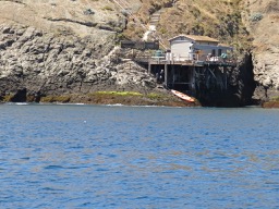
But we – the Bosun and I – think it’s still worth going there to kayak and explore from your boat.
Kyle Ridgeway went ashore in August 2020 and reports —
We all wore water shoes and had one group member “taxi” us to shore, where we jumped out of our dinghy 10 feet from shore, just beneath the dock (which was luckily only waist deep).
Chart & Pic
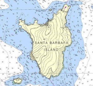
Chart 18756 shows rocks near datum all around the island, most quite close to shore. There are several hazards in the anchorage proper; however, none is marked outside of the mooring buoy at the anchorage.
Enroute
Transit from the Ventura area involves crossing the Pacific Missile Test Range. Refer to the Local Notice to Mariners for contact information. The range is not hot very frequently, but it is definitely a prudent move listen to their recorded message before you head out: 800.648.3019. And, though we checked, we got hailed by a Navy helicopter, which directed us around an unreported hot area. At the very least, monitor VHF #16.
Obviously, any time you head out into the Pacific it’s essential to check the weather. Going to Santa Barbara Island means taking a longer, harder look, particularly at wind forecasts. Among other sources, I like NOAA Graphical Sectors the best. For additional sources and longer (and shorter) range forecasts, see Sailing Wx on this site.
When making the run from the Oxnard/Ventura area, I recommend heading for a point a few miles south of the Anacapa Light. It’s a bit longer than a straight shot, but it gets you clear of the Coastwise Traffic Lane and keeps you clear.
We’ve been fortunate on our trips south and have had great visibility, in fact, at midpoint we could see Anacapa and Santa Barbara Islands simultaneously. On the way home we could see ALL of the northern Channel Islands at one time. Obviously, you can’t expect that and must anticipate low visibility and be aware that not all big shipping is necessarily in the lanes. A sharp visual lookout is essential and AIS or radar – particularly a MARPA equipped radar – make the trip a lot less hazardous.
Approach
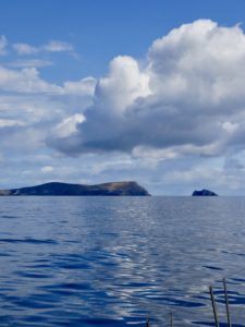
With the excellent visibility we enjoyed, identifying landmarks was easy. Here’s a view of our approach. We’re coming in from the north and plan to circle the island to the west. The hill to the left (east) is the one in the center of the north coast on the chart. The Gibralter-shaped hill to the right is the one on the SW coast and the final hill is Sutil Island.
Other approach landmarks
The Santa Barbara Island Light, located on the NE corner of the island is unimpressive in the daytime. I was once very disoriented by this sort of light on another part of the coast which was new to me.
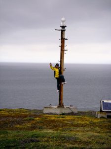
I was searching for a full-on Lighthouse to fix my position, which is what I assumed would house a 20+ mile light. All my nav information indicated I was within 5 nm of the spot, but search as I did, no Lighthouse was evident. Finally, a glint off the light itself revealed that there was no House, just a light on a stick. Had I checked Coast Pilot, I’d have known what I was looking for.
Some sailing lessons come cheaper than others.
Shag Rock is prominent on the chart, but approaching from the north is hidden by the more imposing main island backdrop.
Arch Point does have an impressive arch, but by the time you’re close enough to see it from the north, you already know where you are.
Circumnavigation
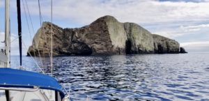
Though the chart shows abundant seaweed and Fagan recommends against transiting between Sutil Island and the main island, we had no difficulty. And in the benign conditions, it was well worth the hour we spent circling the entire island.
Beware of the reef that extends from the NW corner of the island and the outlying submerged rock about 1400 yards west of that, shown on chart as breaking in a moderate swell. We stayed close to the reef, spotting all the hazards easily in the calm conditions and thus remained well clear of that western rock that was invisible at high tide.
The Anchorage
The anchorage is easily located as you approach from the east.
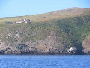
The Ranger’s house cum visitor center is easy to spot on the high bluff and the anchorage is just slightly to the north and down. There is also (at least sometimes) a white mooring buoy to mark the spot.
We anchored close in on our first visit, about 300 yards north of the mooring buoy in about 25 feet of water. We were there on a new moon with a tidal range of about six feet and set the hook with about 150 of chain.
The bottom is noted as rocky and Fagan reports areas of solid rock, so we made sure the anchor set hard.
Hazards
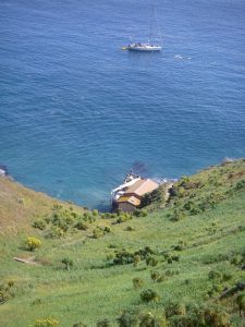
Though the Park Service captains maneuver their boats into the landing, I wouldn’t attempt it. It’s tough and hazardous enough in a dinghy.
I watched Capt. Diane Brooks skillfully maneuver Ocean Ranger into position and hold her there as personnel were transferred. She says the surge is treacherous and they have, on occasion, made the trip from Ventura and deemed it too dangerous to make the approach.
The surge was minimal while we were there, nevertheless a challenge, particularly at low tide.
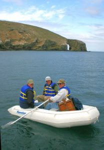
It’s a challenge, too, for passengers who have to make a fairly athletic move to get from the dinghy to the rusting steel ladder. Don lifejackets before you head out.
There were only two people on the island and we were there to visit them. Rather than pull our dinghy to the second story of the pier, we just tied it off on the ladder above the high tide/surge line. We knew that further visitors were unlikely.
Our timing was fine. Had we tried this the next morning, we’d have had a host of people from the tall ship that came in during the night quite angry as they sent boatload after boatload of kids ashore.”
Night Challenges
The wind came up to close to 30 knots on night two of our 2007 visit and was pretty sporty on night one. Looking at the chart, it would seem that you’re well protected from the west wind by the high bluffs.
And that’s true, but the wind swirls around below those bluffs and it pushes you north, then south … fortunately that night, never toward shore. According to our contacts, the swell can also come around the corner and make the ride unpleasant or even dangerous.
A bailout plan is essential as is a vigilant anchor watch.
It’s black as the inside of a cow and the anchor watch is challenged to spot movement by using landmarks ashore. We used our GPS anchor alarm and also set the Anchor App.
Night two on the 2007 adventure, we may have actually been dragging anchor. We mustered the Special Sea and Anchor Detail (everyone who wasn’t an artiste or artist’s assistant) and prepared to get underway. Since first light was less than an hour away, we just stood – alertly – by after starting the engine.
We moved about 100 yards further out to sea and paid out more scope. Our initial position had given us only a few hundred feet between maximum extension and a small reef. In the new spot, we could rest a little easier; however, we were more exposed to wind and swell.
Fagan warns that NE or E winds put you on a very dangerous lee shore. Suicidal, he calls it. We had our tribulations with a west wind and would have been out of there at the first hint of a zephyr from the east.
Attractions
The ocean was alive with critters during our trip and while at anchor.
In 2007, juvenile sea lions accompanied us any time we got in the dinghy or paddled away in our kayaks. In fact, any time we came out on deck, they came out to say hi.
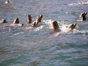
These weren’t babies, more like middle-schoolers who needed more attention than adults can provide. At one point, they came out to talk to a wet suit that had been hung on the bimini.
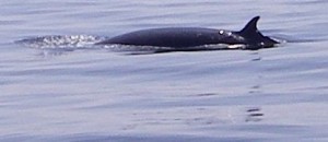
We were in the middle of the Gray Whale migration and saw those leviathans every day. Also spotted a Minke Whale, which is characterized by its lack of a spout. The water was glassy and this one just popped up off our starboard bow and swam parallel with us for some time.
Dolphins, you ask. Billions of Common (hence the name) Dolphins swam by us. Well, probably 1,000 or so in a pod that reached from horizon to horizon. Up to 20 of them would try to ride our bow wave and would stick with us for several minutes only to be replaced by another team.
The water was glassy and we were motoring at about 5 knots. The dolphins stayed with us until we slowed down to let a whale cross our bow.
Going Ashore
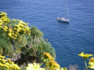
It had been a dry winter in 2007, but we were still treated to a fine display of Giant Coreopsis. For additional info on island plants, go to Cal Flora info
The Brown Pelicans were in their nests and the naturalists had closed off many of the trails so that we wouldn’t disturb the critters. Apparently they’re pretty shy and if they leave their nests, they will not return. Makes for some unhappy babies.
Nevertheless, we were able to hike enough to satisfy ourselves and get a good feel for the island.
This Santa Barbara Live-forever Dudleya_traskiae is apparently in protective custody. Like the rest of the Channel Islands, Santa Barbara has been mistreated, at least from a naturalist’s point of view. Non-native plants own the landscape, and the Park Service was attempting to restore the environment. The Live-forever is endemic to Santa Barbara and gets some pretty special treatment, or at least it did until the island was closed.
Landing Permits NOT Required Permits; it’s your national park. For information about camping ashore, guided tours and facilities (not much), go to National Park Service
Updates
If you have new or amplifying information concerning this anchorage or the surrounding area, please contact Capt. Dan. His e-mail link and phone are top left.


