| Loc: SE San Miguel Island | Lat: N34-03.4 | Long: W120-21.3 | Last visit: Aug 2021 |
| Tide/Sun/Moon/WX | Dist: 0 | Cuyler Harbor | WX |
| Chart | 18727 | San Miguel Passage | NPS Alerts |
| Skipper: Capt. Dan | Boat:Sancerre | captdan | Port: Channel Islands |
| Landing Permit | Not Required | Trail Guide | Local Notice to Mariners |
Beauty and History
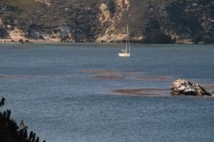
Cuyler Harbor is spectacular and usually empty, but on our 2021 visit, we found 13 boats in the anchorage. That’s not really a crowd, but we’re used to sharing with only one or two other boats.
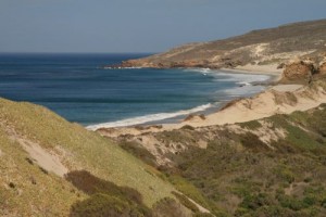
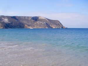
Cuyler Harbor is to our minds, the most beautiful spot to drop your hook in all the Channel Islands. Its remarkable rock formations, towering cliffs and Prince Island, which lies at the mouth of the harbor make this the only real harbor in the northern tier of islands. That said, most local mariners rarely venture here because of frequent punishing winds and high seas. It’s also a bit of a schlep from Oxnard/Ventura. It’s a two day run for us to make Cuyler from Channel Islands Harbor. You could do it in one, but you’ll be sailing at night at one of the trip or the other …. or both.
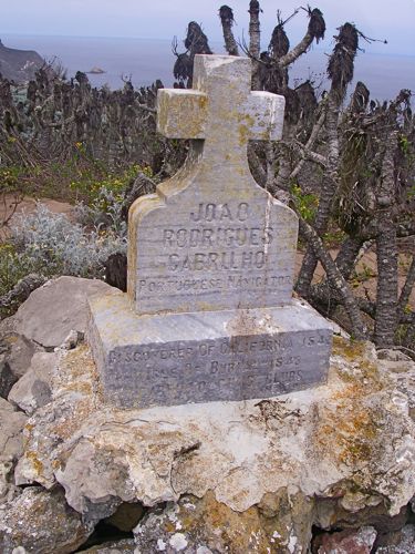
San Miguel is the rumored final resting place of Juan Cabrillo, who “discovered” the island sometime around 1540, and died there after an altercation with the Chumash in 1543. Remember, we said rumored. In any event, there is a marker commemorating his death, wherever that happened.
While further away from Oxnard/Ventura, and more challenging in terms of navigation than most other off-shore destinations, the trip to San Miguel, and Cuyler specifically, is well worth the effort (even considering all of Fagan’s cautionary comments, which are definitely worth reading).
As this is a fairly large anchorage, chances are great that there will be plenty of room and very little company to contend with except for the occasional crabber or dive boat and migrants from the north heading for the Sea of Cortez.
Approach
There are two possible ways in and out of Cuyler. Our first trip to Cuyler was by way of Point Bennett on the North West tip of San Miguel, around Castle Rock, past Simonton Cove and around Harris Point, about two-thirds of a circumnavigation. That’s the long way. It’s also the beautiful way.
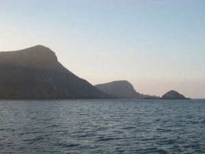
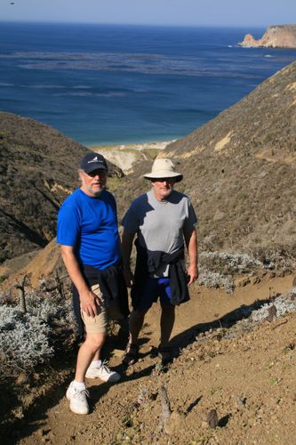
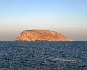
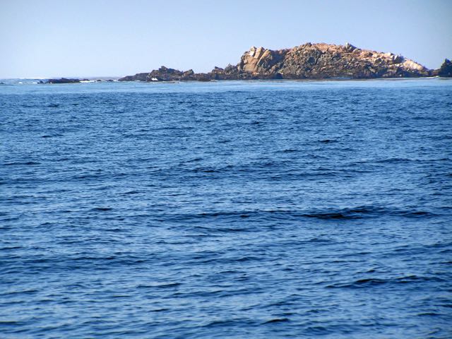
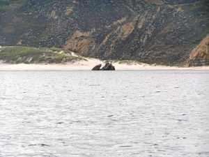
The APPROACH picture below shows Nifty Rock in the foreground, the peninsula a bit closer and Hill 485 and Hare Rock in the background. The shoulder of Harris Pt. is at the far right.
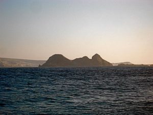
Following our route from the north, first identify Harris Point, which is unmistakable due its conspicuous hill, shoulder, and steep cliffs, and 288′ Prince Island, which lies approximately a mile offshore at the East side of the anchorage.
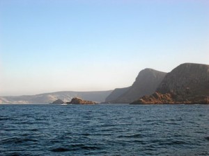
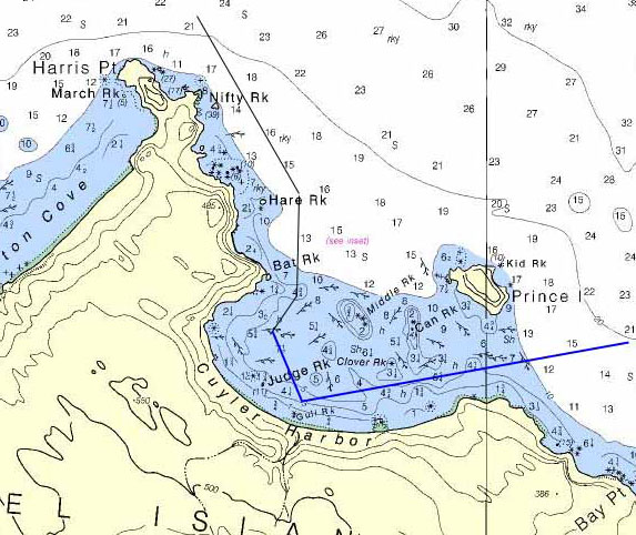
Our approach was from the NNW, keeping well off shore. As Nifty Rock and Hare Rock are 250 yards and 300 yards off shore respectively, we kept about 400 yards off shore lining just left of Nifty Rock and Hare Rock.
After Hare Rock, we sighted Bat Rock and established the same offset, which put us on a southerly heading. We continued about 200 yards past Bat Rock before making a slight westerly turn, keeping a close eye on our depth gauge. We dropped a single hook in about 25 feet of water, quite close to the anchor symbol on the chart.
Part of a prudent sailor’s preparation for a journey to Cuyler should include careful study of the chart, Coast Pilot and Fagan’s Cruising Guide.
In Feb 2011 (I’m not sure I’d recommend going to San Miguel in the winter, but we were very, very lucky and had the best weather we’d ever seen between Santa Ana events), we approached from the north side of Prince Island.
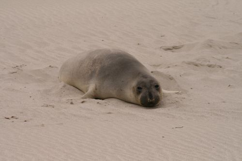
There is a small island near Prince and some hidden rocks just past the end of the island. Once we were abeam those rocks we put Hill 485 at 1 o’clock. The sun was in our eyes and we proceeded slowly until we could identify Hare Rock. From there, we intercepted our earlier course, turning south and passing a few hundred yards east of Bat Rock and continuing south a few hundred yards before turning into the anchorage. We anchored in 30 feet and listened to Elephant Seals squawk, whine, moan and bellow all night.
BTW – when approaching from the east, the breakers on middle rock and others in the center of the harbor make the area look impassable if there’s any sort of swell. Press on and reevaluate the conditions when abeam the west end of Prince Island. It’s quite likely that you’ll find a relatively calm passage to the anchorage. BTW2 – historically this is a very kelpy area, but on our Feb 2011 trip and again in 2017 it was 95% clear.
Anchoring
Conditions were extremely benign while we were there each Fall in 2006, 7, 8 and 17 and allowed us to use a single hook, Fagan cautions that wind and substantial swells can come up suddenly, requiring a second hook, or if conditions deteriorate sufficiently, render this anchorage unsafe. Fagan states “Heavy swells can break in the entrance in rough weather. Entering or leaving Cuyler in these conditions is crazy.”
All sailors speak from experience, just not necessarily their own. Even so the consensus among locals is that this can be a very hazardous spot. On the other hand, Fall provides some excellent weather for this trip and the consensus is Sept. and Oct. are the best months to venture this way.
Departure, the eastern route
We decided not to leave the same way we came in and departed the anchorage and headed south toward Gull Rock, taking care to avoid the numerous kelp beds while monitoring the depth.
About 200 yards north of Gull Rock we turned east and paralleled the shore, staying about 100 yards off while maintaining a course which took us between the shore and Clover Rock, which was awash. We continued on a course that kept us between the shore and Prince Island and stayed close to shore until we were abeam of Prince Island and clear of the reef.
Obviously the reciprocal of our departure route could be used as an approach into the anchorage.
However, it is a somewhat tricky approach requiring careful avoidance of the kelp beds and keeping well inside of Clover Rock. While one might be tempted to set a course midway between the shore and Prince Island heading straight into the anchorage, this would take you between Middle Rock and Clover Rock, both of which are exposed only at low tide, and may shoal up in between them depending on the surge and swell conditions.
Dangers
Kelp beds abound and there are several small reefs/rocks which are only visible at low tide. In addition, Fagan cautions about a foundation of an old pier at the south corner of the anchorage that should be avoided.
Landing and Facilities
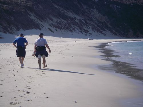
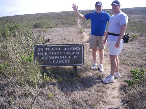
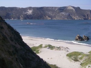
No landing permit is required but you are supposed to sign the register at the trail head before ascending to the ranger station. A guided tour with a park ranger can be arranged by calling the Park headquarters in Ventura at (805) 644-8262. You can also contact the ranger on channel 16. Excursion parties generally meet the ranger at 0900 near the four palm trees on the beach.
Anyhow, we launched the dinghy and met the ranger at the top of Nidever canyon. He juggled his schedule a bit and took us on a hike to the Caliche Forest. Frankly, I was very nervous about leaving Sancerre unattended, so we abbreviated our excursion.
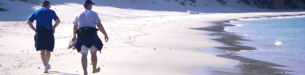
That turned out to be a good decision as the wind came up and the anchor needed tending by the time we got back aboard. I will never leave the boat unattended in this anchorage again, and these days, NPS advises you to leave at least one person aboard.
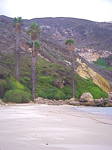
The best place to go ashore is usually at the NW corner of the bay near the palm trees, but you can encounter hazardous surf conditions. Be ready to abort your landing plans or be prepared for a swim.
Fagan also cautions that a landing attempt opposite the path to the ranger camp is to invite a dunking, but in Sept. 2017 there was about a 6 inch break, so it pays to scout the beach before picking your landing spot.
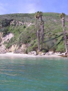
There are two stories that purport to explain the curiously out-of-place palm trees on the beach. First story: the palms are courtesy of a movie company that filmed a feature there in the 1920’s.
Story #2 comes to us from Jeffrey LaBarre, who wrote:
“I was having dinner as a reciprocal guest at the Santa Barbara YC and talking with a couple at the table next to me about my visit to Cuyler Harbor. I was telling story #1 when another older gentleman piped up. He said that, while this story has been repeated many times, it was false. The four palms were planted, he said, by a fellow SBYC member. He said he knew this was true because he knew the man and his son who did the planting and that it was much later than 1935, in the early 50’s he thought (this is, I think, consistent with the size of the palms). I can’t say for certain that this guy was right but it is certainly commonly accepted knowledge at SBYC and I have since heard this from other sources as well.”
I don’t know if/how that story connects with what appears to be the real story at islapedia.com, but frankly, we like the movie-maker story legend better, even if it’s not true.
Mr. LaBarre added “Cuyler WAS used as a location for the 1935 filming of Mutiny on the Bounty but the crew “mutinied” over the remoteness of the location, bad weather (a crew member was reportedly swept overboard and lost), and the constant wind. The site was abandoned in favor of the Isthmus at Catalina.”
There you have it: a true sea story – two plausible accounts and sailors who swear that their version is accurate at least one of which includes the phrase “was there” or the principle “knew someone who was there.”
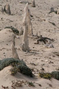
Ecology notes: The environment is recovering after being devastated by ranch animals, mostly feral sheep that were abandoned when the ranching operation was wrapped up. With little ground cover, the wind swept the landscape, gouging sand rivers through the terrain, which are most distinctive in aerial photos. In addition to elephant seals on the harbor beaches, we ran into a pod of humpbacks in 2006 – more accurately – they joined us on our way toward Santa Rosa. Seven (or so) animals including two juveniles. In 2007 and 08, Fin Whales joined us for over an hour of whale frolcking. No whales for us in 2017.
Updates
If you have new or amplifying information concerning this anchorage or the surrounding area, please contact captdan
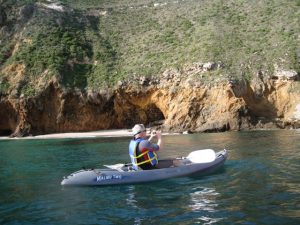
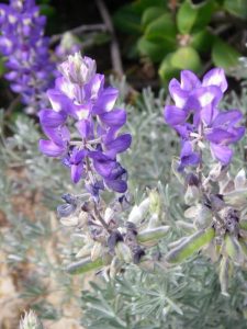
Photos