| Loc: mid-south coast Santa Cruz | Lat: N 34-03.3 | Long: W 119-46.0 | Last visit: Oct 2023 | ||
| Tide/Sun/Moon/WX | Sun/Moon | Prisoner’s Harbor, Santa Cruz | WX | ||
| Navigation | Local Notice to Mariners | NPS Alerts |
Overview
We’ve tried it a couple of times in west winds to 15 knots and have found it fairly comfortable. At around 20 knots, the wind begins to swirl around the anchorage. The side loads were so strong on our last visit that our well-set stern anchor popped free and we swung uncomfortably close to the cliff face. We reset but did not rest easily until the wind abated.
This anchorage isn’t particularly popular because it looks a bit daunting and, to some, claustrophobic. It is a fairly tight fit and suitable for no more than one 40 ft. boat. Additionally, the wind can shift from a strong canyon breeze to an onshore in short order. That turned out to be quite dangerous on our last visit as the shift happened as we were retrieving our stern anchor, which was 50′ or so from shore.
In decent weather, it is usually an acceptable alternative to Frys and only a few hundred yards away.
Approach
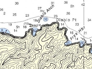
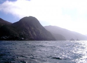
In clear winter conditions, you can spot 2434 ft. Diablo Peak, the tallest mountain on Santa Cruz, as you clear the harbor.
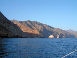
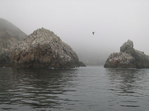
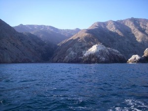
If you’re proceeding west along the shore, the 526 ft. Diablo Point stands out beyond all the other crennalated features. Keep heading for the point and pass Frys Harbor. Stand off a bit in high winds as the seas can be quite turbulent right at the point. Round Diablo Point and the anchorage opens dramatically to your left. Don’t be surprised if the rocks on the beach get up and start wiggling toward the water. This is a harbor seal rookery and the adults are very skittish. The babies will follow.
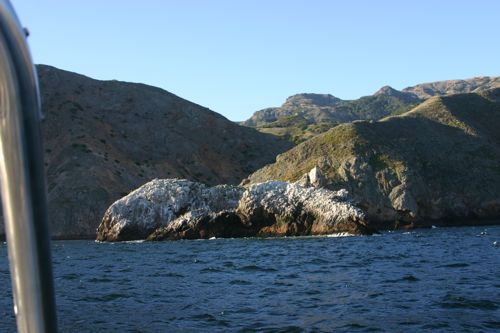
Coming from the east, aim at Diablo Point and look for two islets 70 and 80 ft. high. They’re usually white and easy to pick out at a distance. They mark the NW entrance.
Pass the rocks 100 feet or more to your right, then turn to parallel Diablo Point, splitting the distance between the point and the islets to enter the anchorage.
Anchoring
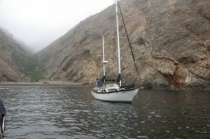
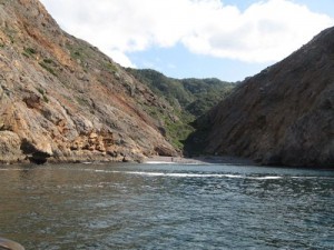
The depth at the mouth of the canyon is about 70 ft. Though I have seen boats on a single hook in here, I always use two. I always back in and am able to turn the boat at the mouth of the anchorage, starting my turn from the downwind side. That’s always been a right hand turn and about 30 degrees short of completion, I go to reverse and rev hard to straighten out and head back with enough sternway for control. (Note: That maneuver might be impossible with a full-keel boat.)
You’re generally well protected, but the winds in the canyon, though not usually strong are almost always squirrely. If it’s calm or if the wind is blowing out of the canyon, I’ll drop the stern hook first in 15-20 feet if it’s low tide. Then we drive forward 300 ft. and set the stern anchor securely. Then we drop the bow hook. I try to stay centered in the anchorage, which can be tricky in the swirling winds. We pay out rode on the bow as we take it in astern until we’ve got 120 ft. out on the stern.
We then set the bow hook with vigor and finally take in excess bow rode.
If the wind is blowing into the canyon, we’ll still back in but drop the bow anchor first, 50 feet or so seaward of the cave on the west wall.
On our last trip, we set the anchor alarm at 60 ft., the minimum we can set on Sancerre, and sure enough, it went off around 0200. We’d been checking our position every hour or so, which was easy since the anchor light illuminated the entire anchorage. Though an alarm at that hour of the morning was well – alarming – we found the anchors were still solidly in place.
We had discussed a detailed bailout plan, but were extremely happy to be able to head back to the rack rather than fight our way out of the anchorage. One thing slightly different about our bailout plan was that if we had to get out, we would tie a fender to the stern rode and jettison the whole mess. In these close quarters, we didn’t want to take time to discuss the options, we wanted to be able to execute the plan with no discussion.
Hazards
None that aren’t charted or visible.
Landing Permits Required
If you intend to go ashore, you’ll need a permit from the Nature Conservancy.
Updates
If you have new or amplifying information concerning this anchorage or the surrounding area, please e-mail Capt. Dan.
Photos