Northwest anchorage Bechers Bay on Santa Rosa Island is well protected from swell, but the wind can come whistling over the low hills. Nevertheless, Fagan deems it good enough to be a refuge anchorage in NW winds to 39 knots.
We were in there in time to enjoy a sundowner, which made the rigging whistle, but not much more. Tough to light the barbecue, however.
Approach
It’s a straight shot into the anchorage, but if you’re doing it near sunset, which seems pretty likely, you’ll be staring into the sun and will be unable to see much of anything.
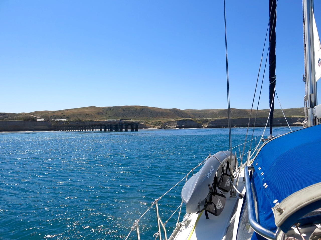
Our favorite spot to anchor at Bechers — about 200 yards ENE of the pier.Note: anchoring in kelp areas brings two hazards — the kelp and the rocks that kelp holds on to.
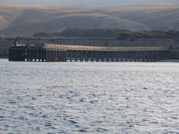
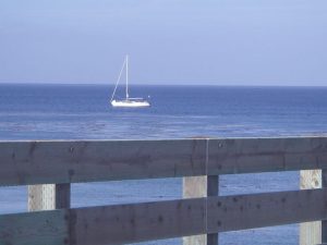
The shoreline near the anchorage is unremarkable. What you’re looking for is the pier, but that blends in with the cliffs and may not be visible until you’re within a mile or two. Even on a severe-clear day it’s frequently hard to pick out the pier. The pic at top makes that point pretty well. We frequently spot the ranch buildings first because of their reflective roofs or the windsock on the dirt runway south of the pier.
Anchoring
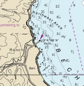
The chart shows a couple of anchoring issues: kelp and rocks. Rob Macfarlane, master of the S/V Tiger Beetle, reported in July 2020 that he got hung up on rocks near our usual anchoring spot. Up to this point, Sancerre has dodged the issue, but it looks like we were just lucky. Here’s Rob’s report:
“I was in 30′ of water just to the north and outside the pier I could hear the anchor chain rattling among rock.
The NOAA chart says ‘rky’, with ‘S’ (sand) just inshore. So I moved over much closer to the existing kelp bed and set there in 24′ of water.
Thanks to Rob Macfarlane, we stand corrected: the bottom in Bechers NW anchorage is littered with rocks.
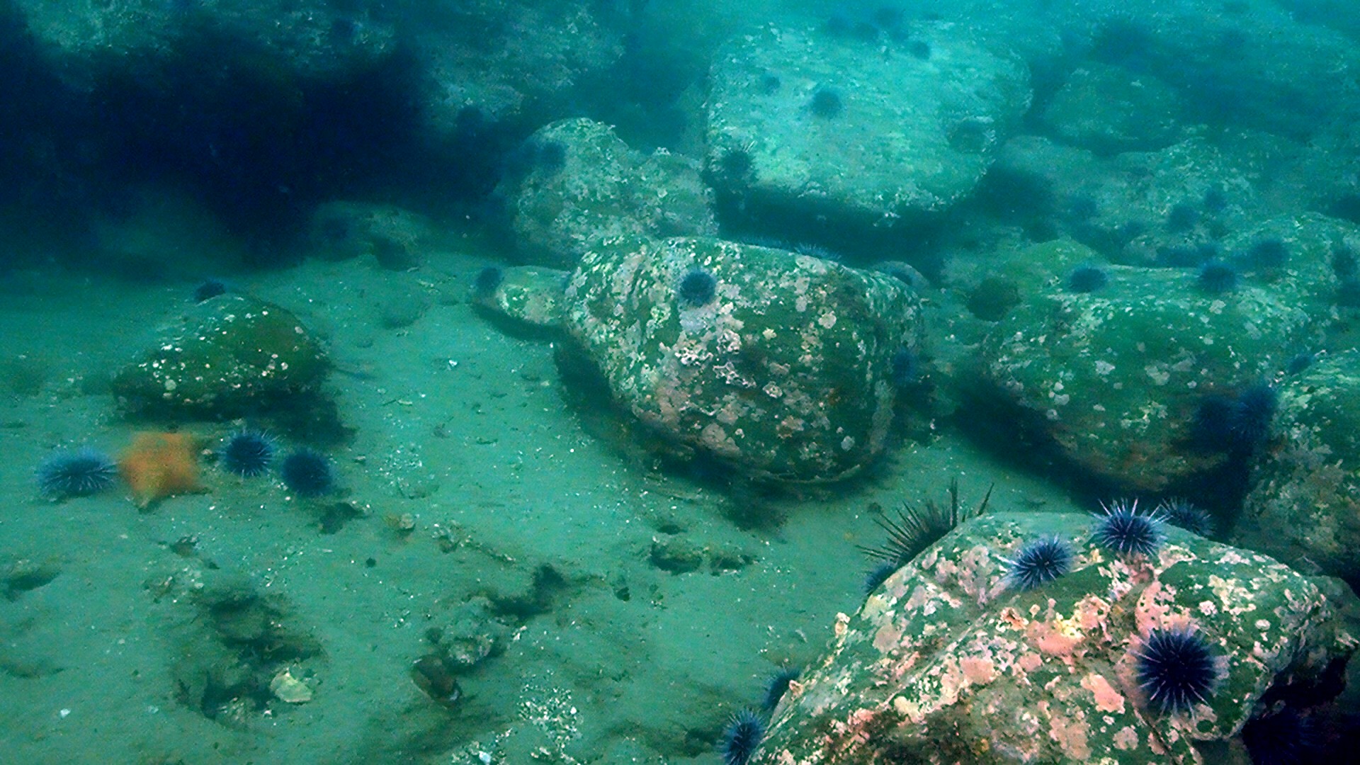
There was some chain rattling going … I put on SCUBA gear and dived the anchor. Turns out the bottom there is flat shelf rock dotted with 3-5′ large rocks. The shelf is covered with 1-2″ of sand.
My anchor (a Rocna) wedged itself under one of the large rocks, the chain wrapped around another large rock perhaps 50 feet away from the anchor.”
Night Approach
Anchored close aboard but seaward of the pier in about 20′
There are three very bright steady red lights mounted on the end of the pier, making close-in navigation a lot less tricky than using radar alone.
Going Ashore
Though the National Park Service has total control these days, there are still some places that they don’t want you to tread. Check out NPS ALERTS for details. Note: scroll all the way to the bottom of that page to ensure you get all pertinent information.
BTW – the Torrey Pines are an easy hike from the pier; however, I do not leave my boat unattended.
Golng ashore in a kayak is relatively easy on the gently sloping beach.
Kayaking and other beach activities are great, particularly in late summer and fall.
Just south of the dirt runway - note windsock top right.
On the road to Torrey Pines, which is closer to SE anchorage
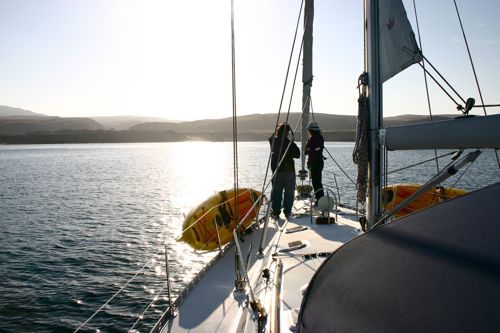
Anchoring under sail. Note farmhouses.
In mid-October, the water was swimmable in trunks, delightful in a wetsuit
Looking toward Carrington Point north of the anchorage.
Skunk Point
Kelp can be an issue. It can also be picturesque if you're not caught in it.
Ranch house shortly after the departure of the last private owners.
View of ranch buildings, pier and Sancerre
South Highway roadsign
South highway
Tool shed/barn shortly after last private owners went to the mainland
Tool shed/barn shortly after last private owners went to the mainland
Tool shed/barn shortly after last private owners went to the mainland
Tool shed/barn shortly after last private owners went to the mainland
Ranch house
The last private enterprise on Santa Rosa involved hunting imported elk.
Once the primary means of hauling, now ready for the antique market.
The ranch was in business for about a century. Here's the last stop for horse drawn wagons.