| Loc: mid-south coast Santa Cruz | Lat: N 34-02.9 | Long: W 119-44.2 | Last visit: July 2021 | ||
| Tide/Sun/Moon/WX | Sun/Moon | Prisoner’s Harbor, Santa Cruz | WX | ||
| Navigation | Local Notice to Mariners | NPS Alerts |
Overview
Platts Harbor is a marginal overnight anchorage. Even a moderate swell will make sleeping difficult, so we’ve only anchored there in calm conditions. The first time we were there, we set bow and stern anchors aligning the boat parallel to the beach and into the swell.
The last time we visited Platts, we opted for a single hook in about 40 feet of water. We veered out about 200 feet of chain, which put our radius very close to the rocks. It had been 10 years since our previous visit. We obviously forgot the lesson that this is a marginal overnight anchorage.
Approach
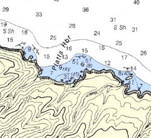
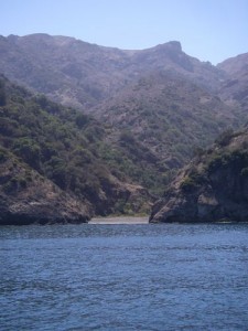
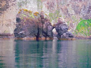
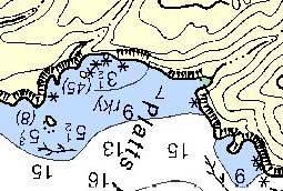
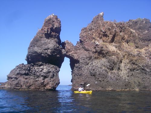
It’s pretty straight ahead, just stay west of the visible rocks on the east side of the anchorage and anchor in 25 ft. or more and you’ll clear all hazards. The 45′ rock is a pretty spectacular formation and makes identifying your location quite easy. The 8′ rock on the way into the anchorage is normally home to a fairly large troop of inquisitive harbor seals.
Anchoring
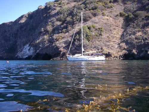
The lay of the land suggests that you anchor perpendicular to the beach. You can see that arrangement in the pictures below. Unfortunately, any swell that comes your way will be on the beam. A better strategy is to anchor a bit further out on a single hook. If you want to be in close, then use two hooks, but set up parallel to the cliff west of the beach.
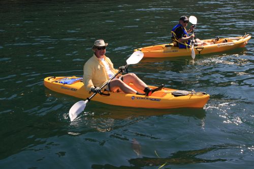
We did that on our second attempt, with the stern anchor in 20 ft. of water, the bow anchor in about 25 ft. We settled in with about 160 ft. of rode forward – all chain – 130′ aft. That felt really solid and we went off to play in our kayaks. If you’re going in that close, check the tide tables carefully. If you’ve got a fairly up-to-date chart plotter, that information is right at hand. If you’re not so equipped, use the link at the top of the page to get tide data, print it and take it with you … particularly if it is a new or full moon.
Going Ashore
We did not have a permit so did not go ashore, but we did get close enough to see that in these conditions, landing would not be a problem. The beach itself is well protected, even if the anchorage is not. Click for permit app
Hazards
None that aren’t charted or visible.
Updates
If you have new or amplifying information concerning this anchorage or the surrounding area, please contact Capt. Dan. His e-mail link and phone are top left.
Photos


Contact
If you’ve got questions or amplifying information, please write Captain Dan or call 805.750.7828.