| Loc: Mainland East of Cojo | Lat: N 34° 27.57 | Long: W 120°0 4.47 | Last visit: Sept 2014 | ||
| Tide/Sun/Moon/WX | Sun/Moon | Harvest Platform | WX | ||
| Navigation | Local Notice to Mariners |
Overview
This was once the landing for the Rancho Nuestra Señora del Refugio, the only Spanish land grant in Sant Barbara county, which was awarded to José Francisco Ortega in 1769. Today, it is a state park.
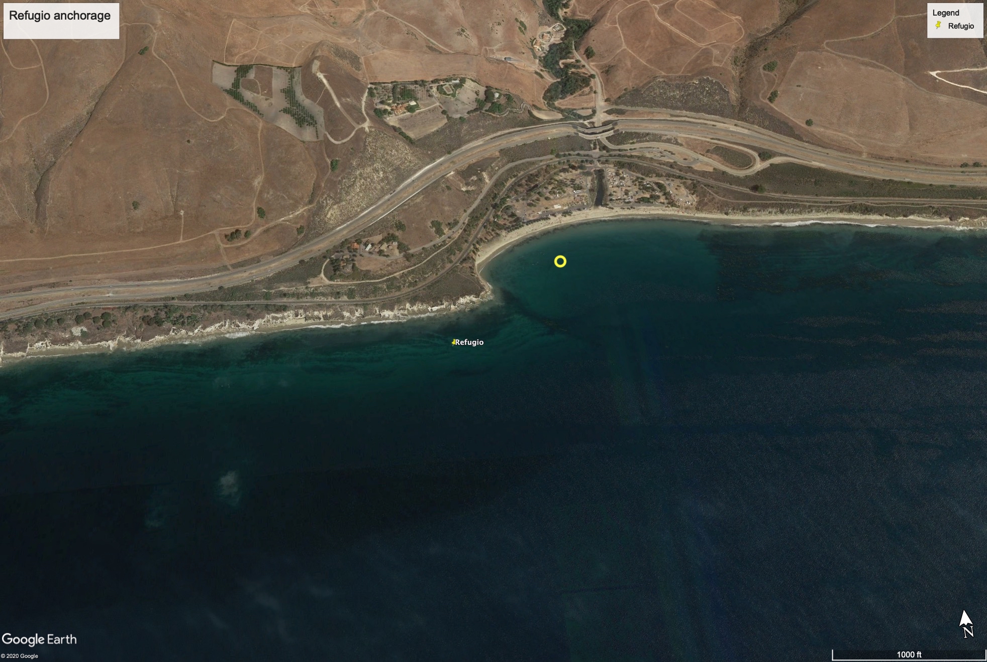
This anchorage is only suitable in settled conditions. Fagan recommends anchoring near the circle inside the small bay, but Sancerre is bit too large and draws too much for that to be comfortable overnight. We anchored outside. There is some protection but this would be a dicey spot with more than 15 knots or so.
We anchored bow and stern to keep us pointed into the swell, which typically runs south along the coast.
Approach
A railroad trestle and large highway overpass are visible at a considerable distance and lie just beyond the inside-the-bay anchorage.
Anchoring
We anchored in about 25 feet of water, sand bottom about 100 yards off the point, and we were prepared to get underway on extreme short notice if wind or sea state worsened.
Uncharted Hazards
Weather. Fog. Unpredictable canyon winds. All of that makes this a dubious overnight anchorage, though possible in very settled conditions.
Updates
If you have pictures to share or new or amplifying information concerning this anchorage or the surrounding area, please contact Captain Dan